Stormcast...

>> Saturday, January 20, 2007

Our in-house computer model has done an EXCELLENT job with these winter weather events over the past couple of years. It really nailed the December '05 ice event and the little event a couple of days ago.

It had consistently showed a period of freezing rain down into the Shelby-Charlotte-Albemarle corridor for many runs in a row....until the last run. The last run kept the whole Charlotte metro as rain. Tough to say whether it was a one-run hiccup or a trend at this point.

I wanted to throw this out there to let you know...I am sticking with my going forecast below for now, but that latest run of our model has certainly thrown even more doubt into the forecast.

Read more...

Quick evening post

Not a lot of time once again, but I wanted to lay out my ideas for the upcoming winter weather threat.

Of the 3 News 14 Carolina markets, the Triad market should experience the most from this event. Right now for the Triad market, I expect precip to move in Sunday afternoon, maybe as a sleet/rain mixture. As evaporation kicks in, the temp drops below freezing for much of the viewing area, and freezing rain becomes the dominant precip type by late afternoon. From the Triad itself on to the north and west, I don't see the temp getting above freezing until around midnight. So, roughly from Greensboro and Winston-Salem on north and west, I think 0.25" of ice accumulation is a possibility before we switch over to rain overnight Sunday night. That could be enough to cause some isolated power outages and a few travel problems, but I am not anticipating a crippling ice storm right now.

For the Charlotte area, precip also spreads in Sunday afternoon, likely beginning as a sleet/rain mix. Like in the Triad, temps then drop to freezing or below from roughly a Shelby to Gastonia to Charlotte to Albemarle line on north and west, and a period of freezing rain occurs. In the area I outlined above, I think up to 1/10" of ice could accumulate. Not a huge deal, but some icing of elevated surfaces is possible.

This is a very tough forecast, and one that could swing one way or another for either market. A few things that are complicating the forecast this evening....

  • Very low dewpoints moving in. That is a bit concerning, and we will watch wetbulbs carefully tomorrow.
  • Some of the modelling, such as the NAM and MM5, showing a real lack of precip across the area. At the moment, I continue to side with the wetter model solutions, although I am taking a bit off of their forecasted precip totals.
  • The classic error of models under-estimating CAD situations. This always sticks in the back of my mind during these situations.
So, there ya go...my thinking as of now. More updates as time allows through tomorrow....

Read more...

Ice storm Sunday???

>> Friday, January 19, 2007

Working the evening shift for the Triad market today. Before I delve into our next wintry weather threat, I want to mention something I have failed to mention before now. We will see a big time blast of arctic air surge into our area by the end of the work week. The exact timing is still a question mark, but by Thursday or Friday, we will be feeling some of the coldest air we have felt in quite some time. At this point, I am thinking highs in the 20s and lows way down in the teens....cold stuff.

Now, on to our Sunday event. I will say right off of the bat....this is a very tough forecast at this juncture. This is the time when, in my opinion, the short range models are still struglling to resolve details and the medium range models don't give you the resolution you need for events like this. So, my confidence is rather low.

But with that said, here are my thoughts as of now. The biggest impacts (comparing the Charlotte, Triangle, and Triad regions) from this system will likely be around the Triad region. I expect precip to roll in Sunday afternoon. It looks like the precip will begin as a period of sleet followed rather quickly by a changeover to freezing rain.

Now, it appears at this point that the freezing rain will not last terribly long in the Charlotte region before changing to rain. But, I am nervous about this because we all know models typically underestimate CAD in the Carolinas. But, my main reason behind this thinking is that the MM5, normally pretty reliable in these situations, has been gradually trending warmer for this event with its past couple of runs. If that trend reverses overnight, it is a warning sign for sure. Plus, the NAM has a forecast of a temp of 32 and dp of 14 in CLT Sunday morning....that is definitely concerning. So, while I am going with the idea of a rather quick change to rain for the CLT area as of now, that could definitely change.

For the Triad, a different story. The 12z GFS BUFKIT data, taken literally, spits out about 1/3" of ice. And, I think the GFS is probably not handling the wedge correctly. I think a few hours of sleet are likely around the Triad, and then a rather extended period of freezing rain. How long temps stay below freezing into Sunday night in this region remains to be seen. At this point, I think the probability is pretty high for ice accumulation in the Triad region, and there is a pretty good chance some significant ice accumulation will occur somewhere in this region.

So, those are my thoughts as of now. The situation should become much clearer as we go through the next 24 hours. I will post more blog updates as time allows.

Read more...

Quick 3pm post...

>> Thursday, January 18, 2007

Everything is winding down with our winter event last night into today. The only real remaining concern is black ice tonight, and I do think there will be a good bit of it for the morning commute tomorrow. All in all, a fun little event....nothing major, but then again, I never expected it to be anything major.

My eyes are now focusing on our next winter weather threat Sunday and Sunday night. It is still too early for specifics, but I continue to have a feeling this could be a big one for the Carolinas, especially North Carolina. This sure looks to have the potential to be a significant event for the Carolinas, but I don't want to get too carried away just yet. Let's get another day of model runs in-house before we dive too deeply into this one...

Read more...

9:30am Thursday Post

Well, the winter event is unfolding for our area. Most folks did see a period of snow and/or sleet this morning, but in all honesty, for most folks in the Charlotte region, the period of snow was a bit shorter than I expected. However, freezing rain is continuing now, and temps have for the most part held steady in the 28-31 degree range. The precip will gradually dwindle down as we head into the early afternoon hours. Most elevated surfaces are building some ice, but I am not anticipating widespread power outages. However, some slick spots will continue on area roads...mainly bridges and overpasses.

Up in the Triad and over to the Triangle, there has been more snow this morning. In fact, quite a few locations in those parts of the state have received over an inch of snow.

Matt Morano and Bob Child continue live weather hits for the Charlotte and Triad markets, respectively. Tara Lane and myself are in-house, and will be on the air to relieve them later this morning.

Thanks for reading!

Read more...

Quick 11pm Comment

>> Wednesday, January 17, 2007

First of all, thank you to all of you who are reading my blog. By far, today has had my highest number of hits since I have been tracking it, and I sincerely thank you for reading.

Now, a quick comment on the winter weather. Pay no attention to the movement of the precip moving through Georgia in SC. You might think "oh well, that stuff is moving east and not north up our way." But, that precip really has nothing to do with what should develop into our area late tonight. Once the low pressure near the SC coast gets cranking later, that should get the necessary mechanisms going to spread the precip northward into our area.

For the Charlotte region, I still think somewhere between 4am and 7am is when the precip will start.

Checking temps and dewpoints, most of the Charlotte region is in the mid 30s with dps in the low to mid teens. Most of the Triad region is in the lower 30s with dps in the lower teens. In other words, almost all wet bulb temps are in the 20s, and it should remain that way until precip onset. So, all in all, I have no changes to the forecast ideas I have going.

Obviously, a busy day tomorrow. I will be on air for the midday shift for Charlotte tomorrow. Matt Morano will handle the morning shift, and Jeff Crum will handle the evening shift. Up in the Triad, Bob Child will handle the morning shift, Tara Lane will handle the midday shift, and Monte Montello will handle the evening shift. You can turn it to News 14 Carolina all day tomorrow for live weather and news hits. We will be with you as long as the storm is.

Time for a bit of sleep now. Everyone have a good night, and for all of you winter weather fans, I hope this is an enjoyable little event for you.

Read more...

7:30pm Wed. Update

Some tidbits from the 18z NAM data via BUFKIT....

For GSO, shows snow and/or sleet through midday, then some freezing rain and eventually a bit of rain. If the morning activity falls as snow, still shows a couple of inches.

For CLT, it shows a mainly sleet or freezing rain event before ending as a bit of rain. Looks like about 0.25" of ice, taken at face value.

For CLT, strangely enough, the 7pm temp and dewpoint is exactly what the ETA MOS data had forecast for this time. For GSO, the temp is 5 degrees below the MOS data and the dewpoint is 1 degree higher. Temps and dewpoints will be a key to this event. The colder we get tonight and at the onset of precip, the longer any potential change to rain tomorrow will be delayed.

Read more...

Winter Storm Warning

Winter storm warning coming for the Charlotte metro area.....per the NWS.

Read more...

1pm Wednesday Update

I am very pressed for time, but here are some thoughts on our upcoming winter weather scenario.

First of all, I think the NAM is likely handling the thermal fields better than the GFS with this system. It often does in wedge-type scenarios. Also, surface temps are running colder right now then most modelling forecast.

the 12z NAM, based on BUFKIT data, shows the following.....

  • For Charlotte, snow, possibly mixed with sleet, spreading in during the predawn hours and lasting until mid-late morning. At that point, freezing rain becomes an issue.
  • For Greensboro, snow arrives by daybreak and continues until early afternoon. At that point, some freezing rain is possible.
  • The NAM also prints out about 0.25" of ice for CLT, but I am not sure I buy that exact scenario.
So, at this point I think the Charlotte area will see snow, maybe mixed with sleet at times, arrive during the pre-dawn Thursday. By midday, we will probably be lookign at some freezing rain. I think this area has the possiblity of 1-2" of snow, then possibly a layer of ice on top of that. Travel could become tricky, especially on beidges and overpasses.

For the Triad, I think 1-3" of snow are a good possiblity, with the possibly for some minor icing on top of that. As in the Charlotte, some travel problems could certainly arise.

I will update the blog as I can. And certainly, stay with News 14 Carolina through the winter weather event. We plan on having full weather staffing for live weather hits through the entire storm.

Read more...

Thursday...

>> Tuesday, January 16, 2007

Real quick note before bed on our possible Thursday event. Both the 0z NAM, which just rolled in, and the 18z GFS BUFKIT data indicate that CLT will not get the surface temps abover freezing until 1pm or so Thursday....that means below freezing temps all morning as the precip is falling. Will be in the office tomorrow, and will try to delve into some specifics then....Stay tuned!

Read more...

Wintry Possibilities Ahead

I don't have a lot of time right now....posting while the kids are finishing up their afternoon nap. But, I see a couple of potentail winter weather possibilities ahead for North Carolina.

First of all, I still think that Thursday into Thursday night could bring some wintry weather into the state. Granted, it looks like any precip that falls with this system will be rather light, but it could be a situation that many spots get a quick shot at some snow before changing over to some sleet or freezing rain. We will keep evaulating this one. But again, I don't expect anything major at this point due to the light nature of the precip. Stay tuned...

A second, more substantial system will move through late in the weekend into early next week. The 12z European run today sure looks like a fairly major hit of snow and ice for the Carolinas. Keep in mind, we are not talking about some system 10 days away anymore....this is 5-7 days from now! The GFS does also have this system, and taken at face value (the 12z run), it shows a relatively quick hit of wintry weather before a likely changeover to rain for much of the area. The European keeps an area of high pressure in a very favorable position for cold air damming (CAD) in the Carolinas, and that is why it shows a much mire significant hit of wintry weather for us.

Lots will change with that second system, and a big key for us will likely be keeping the high pressure in a favorable position for CAD. If we lose the CAD, we probably lose the wintry weather potential.

There are certainly lots of issues to resolve, but at least winter weather lovers around here have something to keep an eye on at the moment!

Read more...

Thursday???

>> Monday, January 15, 2007

Well, I mentioned yesterday that the GFS has been sptting out some precip on Thursday, but so far, it had pretty much been on its own with that idea. However, check out this 84 hour chart off of today's 12z NAM.

Obviously, this run is definitely on board with printing out some precip for the Piedmont. It looks like the 12z Canadian global model is on board with printing out some precip for the Carolinas later Thursday, although the heavier amounts stay just south of Charlotte. The 0z European (I haven't seen the 12z yet) definitely prints out some precip as well.

So, what does all of that mean? Well, I think the odds are now in favor of some precip falling across the Carolinas Thursday or Thursday night. And, at least with my first glance through here, I think there is a pretty good chance that some wintry weather could be involved as well.

This is one of those situations where we will definitely need to see another day or two of model cycles before we can say anything definitive. Let me make sure I am clear. I think the odds are increasing for the chance of some wintry weather, mainly in North Carolina, Thursday or Thursday night. But, do not rush out to the grocery stores just yet (unless you, you know, need groceries)....things will probably change!

On a personal note, got finished with the kids doctor's appointments this morning. Baby had 4 shots and the 2 year old had 1 shot....so, let's all hope for the best in the East household this evening.

I will keep watching the data as it comes in, and I will make some posts as I have a chance. Thanks for reading!

Read more...

Next week getting clearer

>> Sunday, January 14, 2007

In last night's post, I mentioned the range of possibilities regarding next week's weather. I have much more confidence in most of the forecast ideas for the upcoming week as I sit here this evening compared to last.

Here are some of my thoughts....

  • One more warm day tomorrow with highs near 70.
  • Arctic front moves through Monday night. Look for a few showers Monday night into Tuesday morning, but I think the precip ends before any chance for wintry precip.
  • Tuesday will likely feature temps falling through the 40s much of the day.
  • I have given in and tweaked my highs up into the lower 40s for Wednesday and Thursday. I have had those days in the 30s for several days now, but I gave in to the model data this evening and have nudged up those temps a bit. However, that will still be cold and will feel like a real slap in the face after this weekend's warmth. I will probably wind up wishing I didn't chance those highs. We shall see...
  • Most modelling in agreement that the rest of the week will be chilly and dry. Another shot of colder air arrives for next weekend with highs again in the 40s by then.
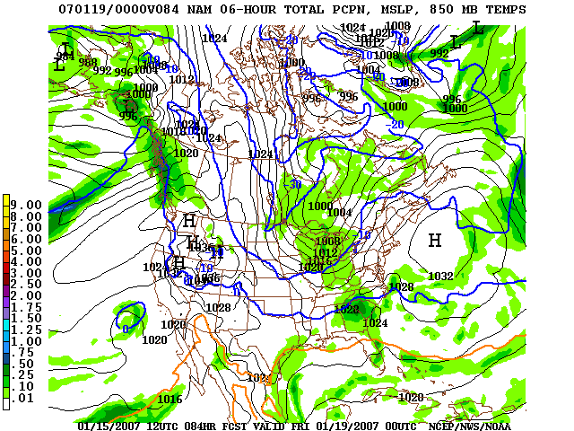
  • The GFS has at times (the latest being on the 18z run today) wanted to print some precip out around here Thursday or Thursday night. If that were to occur, temps would likely be cold enough for a tricky forecast. However, I am skeptical that that precip will even occur at this point.
  • It still looks like the next big storm system will likely roll through around the 22nd or 23rd. The GFS has been crushing that system with the northern branch on the last several runs, but the European is holding on to it.
  • I still think much of the rest of the month will feature normal to below normal temps. That will likely continue into at least much of the first half of February as well.
I know there a lot of folks out there that want to see snow. I am one of them. Here is what I can offer you....The pattern that I think we will be in for at least the next 3 or 4 weeks is one that usually lends itself to at least the chance for some wintry precip at times in the Carolinas. I cannot guarantee that we will see snow, but I would be somewhat surprised if we make it through mid-February without at least one good shot at snow or ice. It is been a rather significant snowless stretch over the Piedmont, and I sure hope we can break that over the next several weeks.

Now, up in the North Carolina mountains, I think some snow will fall later Tuesday into Tuesday night, especially in the favorable NW facing slopes. And, for the ski industry, temps look good for a lot of snow-making Tuesday through next weekend. So, ski conditions should get quite good as the week progresses!

Some busy off-days coming up for me. Tomorrow, 2 of our kids have doctor's check-ups in the morning, then the afternoon will be spent taking down all of the Christmas decorations. I know...it is late. But, since we were out of town last weekend, this is really the first opportunity to do it. I will also take the opportunity, since I will be on the roof, to use the new blower we got for Christmas to blow the remaining leaves out of the gutters. That will sure beat pulling them out by hand like I did 6 weeks ago.

And, one final note on this suprisingly long-winded post.....my wife and I are huge fans of '24', so it is with rather giddy excitement that we anticipate tonight's season premiere. The DVR will be active this evening, and we will catch up on Jack's troubles after I get home from work.

Although time will be limited over the next couple of days, I will try to make a post or two, especially I see something "interesting" in the offing for our area. Thanks for reading, and have a great night!

Read more...

  © Blogger templates Shiny by Ourblogtemplates.com 2008

Back to TOP