

Thursday???
>> Monday, January 15, 2007
Well, I mentioned yesterday that the GFS has been sptting out some precip on Thursday, but so far, it had pretty much been on its own with that idea. However, check out this 84 hour chart off of today's 12z NAM.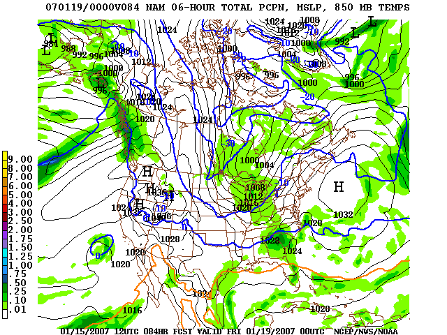 Obviously, this run is definitely on board with printing out some precip for the Piedmont. It looks like the 12z Canadian global model is on board with printing out some precip for the Carolinas later Thursday, although the heavier amounts stay just south of Charlotte. The 0z European (I haven't seen the 12z yet) definitely prints out some precip as well.
So, what does all of that mean? Well, I think the odds are now in favor of some precip falling across the Carolinas Thursday or Thursday night. And, at least with my first glance through here, I think there is a pretty good chance that some wintry weather could be involved as well.
This is one of those situations where we will definitely need to see another day or two of model cycles before we can say anything definitive. Let me make sure I am clear. I think the odds are increasing for the chance of some wintry weather, mainly in North Carolina, Thursday or Thursday night. But, do not rush out to the grocery stores just yet (unless you, you know, need groceries)....things will probably change!
On a personal note, got finished with the kids doctor's appointments this morning. Baby had 4 shots and the 2 year old had 1 shot....so, let's all hope for the best in the East household this evening.
I will keep watching the data as it comes in, and I will make some posts as I have a chance. Thanks for reading!

0 comments:
Post a Comment