Saturday evening...

>> Saturday, December 16, 2006

Well, the 0z Canadian discussed below is an outlier amongst the computer models....most models just show a slow-moving cold front moving through our area late in the week. Granted, the GFS has occasionally shown some cold air damming signals, but taken literally it is too warm for anything but rain. So, at the moment, I am not overly concerned about wintry weather potential around here next week or weekend.

However, the models continue to really struggle trying to figure out this complex split-flow pattern. So, I don't think it is wise to definitively say anything will or won't happen over the eastern US between now and the end of the year.

But, I will stand by my statement that I think from next Wednesday on, most of the rest of December should be relatively close to average temp wise. And, we could see a decent shot of colder air a time or two between now and the new year. I think this "blowtorch", significantly above average weather pattern is about to come an end.

One of my favorite teleconnections is eastern Asia. Often times, the upper air pattern that is occurring in east Aisa now tends to generally occur over the eastern US about a week or so from now. And, using that teleconnection, I feel fairly confident that we will not see this very warm pattern return after it leaves next week, at least through the new year.

I wish I could add more specifics about any storm systems over the next two weeks, but at this point, I simply cannot. So, I say stay tuned.

Read more...

Ice???

The 0z Canadian model has come in with the solution below for next weekend....
That is a Gulf of Mexico low pressure area about to come up the East Coast with a well-defined cold air damming signal from the Northeast right down through the Carolinas. That set-up would threaten the Carolinas with some wintry weather, probably ice.

The 0z GFS and to some extent the 0z European models are at least somewhat on board with that general type of set-up.

Now, I certainly am not saying we are going to have an ice storm next weekend. But, I did want to discuss with you what a couple of models were showing for about one week from now.

The models have really been struggling in the medium range, so this general idea will probably change. However, it is certainly interesting to watch!

Read more...

Friday Evening Post

>> Friday, December 15, 2006

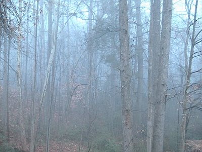
This is a shot taken of the woods out behind our house this morning. As you can see, the fog was quite dense. I know when I was driving to take Jayden (my oldest daughter) to preschool this morning, the visibility was less than a tenth of a mile....kinda felt like taking your life into your own hands when pulling out onto roads!

Speaking of preschool, today was the Birthday Party for Jesus for Jayden's class. All of the parents were invited, and it was neat to be there and see how things are going in school. My wife and I already seem to get very few details about how school is going from Jayden...I can only imagine how it will be as she gets older! The teachers do a great job with those kids, and it was a fun experience this morning.

As far as the weather is concerned, unseasonably warm weather will continue through Monday. But, as I have been mentioning for quite some time, we will transition back to a colder weather pattern later next week.

It seems the picture next week is becoming a bit clearer....however, in general, many of the computer models are still a convoluted mess. It appears a cold front will slip through, likely in dry fashion, Tuesday. Behind that front, highs look to mainly be in the 50s for the rest of the work week.

A 500mb low pressure area will eject out of the Southwest later next week. This type of scenario is one that computer models typically handle very poorly. The 0z run of the GFS tracked the 500mb low right over the Carolinas late next week. So, due to the very cold air aloft associated with the upper low, that run of the GFS featured a shot at some wintry precip for us as the low moved overhead.

However, subsequent GFS runs have shifted the track of the low farther north, and I think that farther north track is likely the correct one. The European model agrees with the farther north track as well. So, at this point, I am forecasting some showers later Thursday into Friday. There will likely be some wintry weather underneath that upper low, but at this point I think that will up over the Ohio Valley and not here.

Temps for Christmas should be relatively close to average for that time of year (50s for highs, 30s for lows). However, I like the idea of a big trough amplification around the 26th or 27th that could send a shot of cold air in here.

Long story short, I think this overly warm weather pattern ends next week, and the rest of the month will feature near or below average temps in general.

Read more...

Look North

>> Thursday, December 14, 2006

Due to the intense solar storm occurring, some places in NC just might catch a glimpse of the Northern Lights tonight.....get in the darkest spot you can and look generally northward. Let us know if you see anything!

Read more...

"The Weather Outside is.......Delightful."

Let me say this....I am a lover of cold weather and snow. So, mild weather in December is not what I would ideally draw up if I were in charge of the weather maps. And I know there are a lot of fellow cold and snow lovers out there as well. But, putting my love for snow and cold aside.....boy, the weather sure is nice out there. And, we will continue seeing unusually mild weather right through the weekend and into Monday and Tuesday of next week. In fact, I think we will see some lower 70s as we get into early next week. Pretty amazing stuff for December.

But, fellow cold weather fans....take heart. Changes are coming.

The models are still all over the place with the timing of this, but I am quite confident that we will transition back to a colder weather pattern by the end of the work week next week, and that colder weather pattern will likely hold for much of the rest of the month.

Here are my thoughts on some specific ideas with this transition....

  1. Cold front moves through around Wednesday...some showers associated with it.
  2. Colder air takes hold by Thursday and Friday, and it remains chilly deeper into the week of Christmas.
  3. A deep upper air low back in the Desert Southwest will provide us with many challenging forecasts from roughly the 23rd on.
  4. The potential exists for some sort of wintry weather situation to materialize by the end of the month in the Southeast US....but I can't be more specific at this point.
And, if you are keeping score at home, the December forecast from my initial Winter Forecast issued back on November 18 for Charlotte and the surrounding areas was a monthly temp averaging 0.5 degrees above normal. In fact, here is a paragraph from that forecast discussin December...

"I feel the "core" of this winter will occur during the months of January and February, and probably some of March as well. December will probably feature some wide temperature swings, but I think the month as a whole will average near or slightly above average for temperatures. My forecast for CLT for December temps is +0.5 degrees."

This month has certainly seen some wild temp swings....from record cold earlier in the month to near-record warmth through the mid-month period. As the month is unfolding, CLT might wind up being a bit below average temp-wise for the month, but I certainly think the December ideas laid out in the forecast held merit.

If you are having some sleep-troubles and would like to read the whole discussion from back on Nov. 18, you can do so going to the address below...

http://mattheweast.blogspot.com/2006/11/winter-ideas-for-charlotte-and.html

Read more...

CME headed our way...

>> Wednesday, December 13, 2006

http://www.space.com/scienceastronomy/061213_solar_storm.html

Read more...

Zzzzzzzzz

That is about how exciting the weather pattern is across our part of the country for the next 5 days or so. To be fair, the weather will be very nice with lots of sun and very pleasant afternoon temps. But, if you are looking for excitement, look elsewhere.....such as the Pacific Northwest, where a big-time storm system will slam that area over the next 36 hours or so.

Now, I do think our weather will get more interesting as we head through next week. The GFS is very bullish on developing a "wedge" Tuesday and Wednesday, which, if that verifies, would likely drop at least our high temps back near or below average.

But overall, I really do think we make a transition back to a colder weather pattern by the end of next week. I expect Christmas will definitely feature much more December-like temps, and there is a fairly strong possibility that the Christmas holiday will feature below average temps. And, there have been some indications of storminess around that time-frame as well, but let's not get carried away just yet.

Outside of the weather world, my family has been playing the "Let's Pass Around Some Annoying Little Cold" game for the past week or so. It seems yesterday and today have been myself and my oldest daughter's turn to have it. Nothing bad....no fever or anything serious. Just a messed-up nose and occasionally sore throat. Feels more like allergies than anything else.

And, goofy me had an older version of our current work schedule at home. So, I get in to work this morning anticipating doing midday weathers for the Triad and Charlotte markets only to see I was actually scheduled to be on the evening shift in the Triad. I am almost always vigilant about checking the current schedule....guess this one just "slipped past the goalie." My goof-up....

Read more...

Sunday Evening Thoughts...

>> Sunday, December 10, 2006

A rather benign weather pattern is settling in across much of the eastern U.S. The arctic airmass that moved in a few days ago continues to modify, and I think most lows will be close to 30 degrees tonight. Highs return to the 60s tomorrow.

I continue to think that the majority of the next 10 days to two weeks will be mild for our part of the country. However, toward the end of the month, there are some signs that a colder pattern for our area will try to return . Give me some more time to analyze that.

On another note, I was disappointed to see our Panthers lose again today. I have become a pretty big fan, and to see the team struggling like they are is disappointing. However, I still think if the team can get it together and win out, the playoffs are still a strong possibility. But, another loss is probably the nail in the coffin. Fans, don't give up.....keep pulling for the guys....

I am wrapping up another work week for me tonight. I will be off for a couple of days....back in the saddle again Wednesday here at News 14. In case you haven't thought about it, Christmas is only 2 weeks away. Still a lot of Christmas preps for the East's, so a lot of the off days will be spent associated with that.

At any rate, if something catches my attention, I will post about over the next couple of days. Otherwise, see you Wednesday!

Read more...

  © Blogger templates Shiny by Ourblogtemplates.com 2008

Back to TOP