>> Wednesday, October 04, 2006

Lots going on lately and not much time for blog posting. Sorry about that....

Warm weather continues through tomorrow, but then big changes take place to finish the work week. First of all, a cold front moves through tomorrow evening and gives us some shower and storm chances. But the big changes are what happens behind that front.

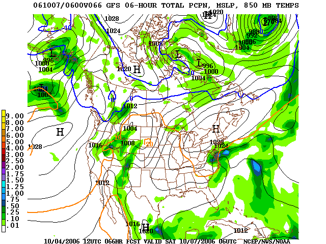
A big upper level low dives into the Carolinas and helps develop a surface low along the coast.Exactly how close to the coast that low develops will determine whether or not we have a couple of raw, rainy days Friday and Saturday. At this point, I think rain Friday looks like a fairly safe bet, but Saturday and Sunday are in question. The European model led the charge with its 0z run today in developing the coastal low a little farther eastward, and now it appears the 12z GFS is going the same. So, we might escape with the weekend looking OK. However, it will definitely be much cooler with highs in the 60s Friday and Saturday. Places like Mt. Airy will likely remain in the upper 50s for highs Friday afternoon.

Tropics are winding down and I think any major hurricane threat has ended.

I am putting together my winter ideas now, and I will post them in this space sometime over the next week or so.

Have a great day!

Read more...

>> Friday, September 29, 2006

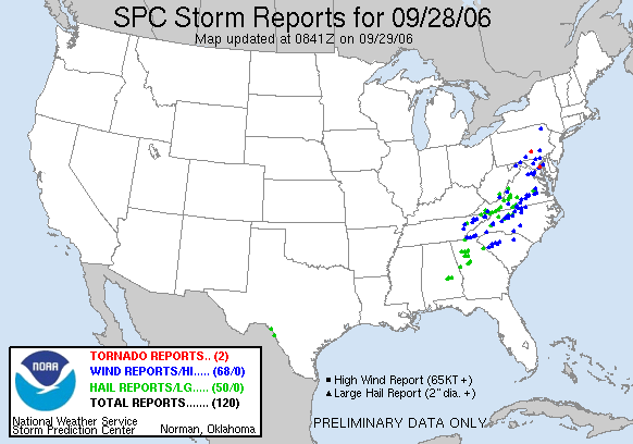
There were indeed some pretty intense storms yesterday evening around the Carolinas. The most concentrated wind damage reports came in from the Triad region over through the north part of the Triangle. Here is the storm report map from the SPC...the blue dots represent a wind damage report.


Here is an image sent in to us from Mike in Hillsborough...nice shelf cloud rolling in.


How about that weather out there today! CLT airport dipped all of the way down to 47 this morning, and I think many of us struggle to get out of the upper 60s today. As I am typing this, the summit of Grandfather Mountain is sitting at 30 degrees! Tonight will be another chilly one with lows well down into the 40s. The NC mountains will see a frost, and a few spots will even see a freeze. Grab a jacket as you head out to watch high school football this evening as temps will dip into the 50s by the end of the games. Football weather! Great weather continues through the weekend.

Read more...

>> Thursday, September 28, 2006

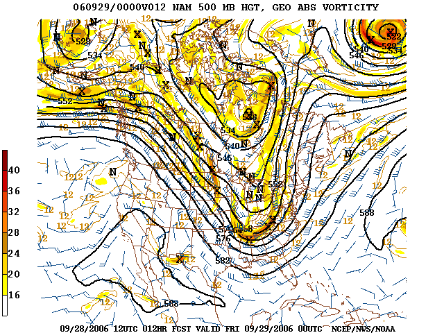
Quick post about our severe weather chances through this evening. Very strong winds aloft with the approaching storm system. Below are the 500mb and 300mb charts valid at 8pm tonight from the 12z NAM.

The winds at 500mb easily exceed 50 knots this evening, and any storm with a strong enough updraft to reach that layer can tap those winds and bring them down to the surface.

Factors in favor of some severe weather through this evening....

  • Negatively tiled trough
  • Looks like NC is close to if not in the right rear entrance region of a 300mb jet streak
  • Temps have warmed into the lower 80s in many spots
A factor against severe weather chances this go-around are relatively low dewpoints. Dewpoints remain in the 50s this afternoon....while that is moist enough for some severe weather, generally you need dewpoints in the 60s to get the really serious stuff.

So, all in all, I certainly think some damaging winds are possible this evening. I can't completely rule out the risk for an isolated tornado or some small hail, but winds definitely look to be the main severe weather threat. Flash flooding does not look to be a problem due to the fast-moving nature of the storm system.

A pretty nasty storm fired over Burke county this afternoon, but there have been no reports of damage with it. There have been some storm reports come in from eastern Tennessee.

Stay with News 14 Carolina for all of the latest information. We will walk with you through the storms if/when the occur.

Read more...

  © Blogger templates Shiny by Ourblogtemplates.com 2008

Back to TOP