Odd weather day...

>> Wednesday, May 28, 2008

We have a cold front sliding to our south this afternoon, and lots of shower activity is continuing. Most of these showers are very slow-moving, and some locally heavy rain has fallen in a few spots.

Temperatures are actually dropping this afternoon as cooler air presses in from the north. In fact, Greensboro is already down to 59 at noon!

The showers end this evening and temperatures will be in the lower side of the 50s in many spots...possible even a few upper 40s.

Sunshine builds back in tomorrow with highs in the 70s. Enjoy tomorrow because it is looking quite warm and muggy for the weekend into next week. I think many spots will see their first 90 degree reading at some point over the next week, and it will be muggy to boot.

Some scattered storms will be possible over the weekend, and again toward mid-week next week.

I also am keeping an eye on potential tropical issues later next week....sure looks like summer!

Read more...

Sunday Evening...

>> Sunday, May 25, 2008


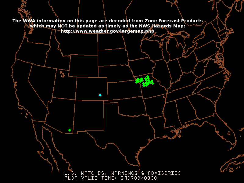
Another big severe weather outbreak is occurring this evening over the Plains...and we are talking all of the way from Minnesota to Texas. Notice all of the watch boxes above in effect as I type. Those showers and storms are near a cold front that will drop in here Wednesday...albeit in a much weakened state. I expect some showers and storms around here later Tuesday night and Wednesday, but the severe weather threat is yet to be determined.

And, I always like to throw out there little things I am keeping an eye on. A good deal of computer modeling continues to indicate the chance of some sort of tropical development taking place in the western Caribbean late in the week or next weekend. It is something to watch...remember the Atlantic tropical season officially begins one week from today. Below is a frame from the 12z GFS for late in the week.


Read more...

Beautiful holiday weekend weather

The weather today and tomorrow will just be fantastic with lots of sun and warm afternoon temps. Highs today should push the upper 70s to lower 80s with highs well up into the 80s tomorrow.

Our next chance of rain and storms comes in mid-week.

Let's all take some time today to remember those that have fallen in defense of this great country we get to enjoy. And let's also take time to thank all of those who have served.

One final note....don't know if you caught any of the coverage on the national cable networks of the tornadoes yesterday, but here is a snippet of CNN's coverage.

Read more...

  © Blogger templates Shiny by Ourblogtemplates.com 2008

Back to TOP